
The two-day, one-night Cape of Good Hope Hiking Trail follows a circular route of 39km. The trail took us along cliffs and windswept beaches, past shorelines and shipwrecks, offering incredible views of fynbos reserves and the raging ocean along the way as we traversed Africa’s (almost) southern tip.
This walking trail wends its way along both coastal edges of the Cape of Good Hope Nature Reserve, allowing us (trekkers) a halfway rest in charming overnight huts near Cape Point.

I opted to tackle the trail in an anti-clockwise direction with the idea in mind of getting the longer stretch (24km) of the hike behind us on day one.
We left the main gate at 9am, followed the rocky path up to the summit of Rooihoogte and then descended to Sirkelsvlei which is the largest fresh water body in the area. Although it has no obvious inflow, the vlei rarely dries up as it is filled by underground aquifers.
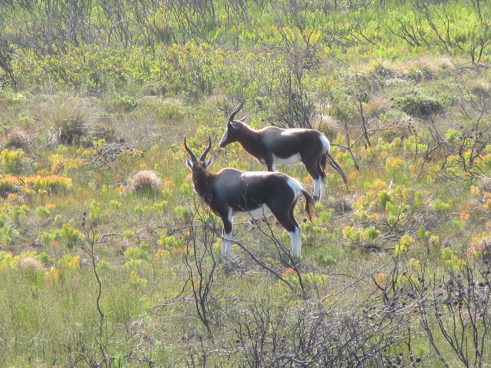


The trail then heads towards the coast and cuts through a restricted area that only overnight hikers are allowed to traverse. We saw plenty ostrich and antelope here and the fynbos is magnificent.
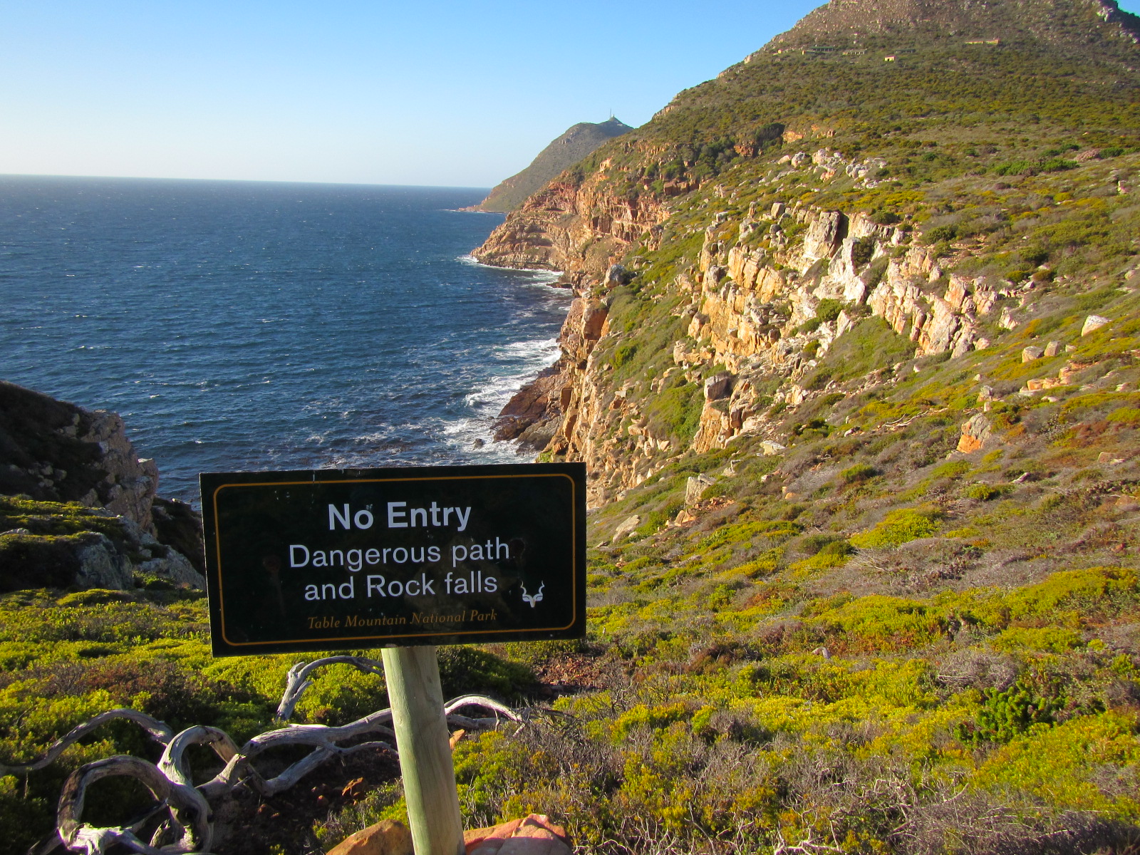
The coastal hike is breathtaking. You have to navigate over boulders and some areas through tunnels in the dense bush.
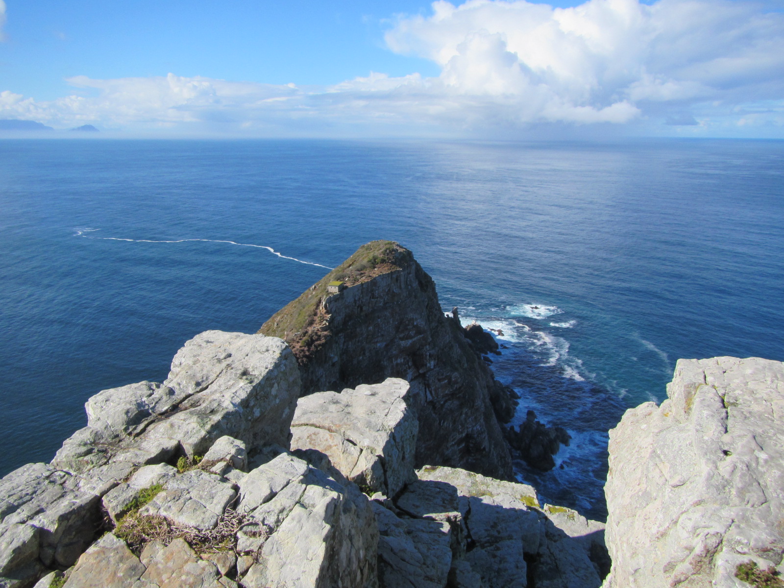
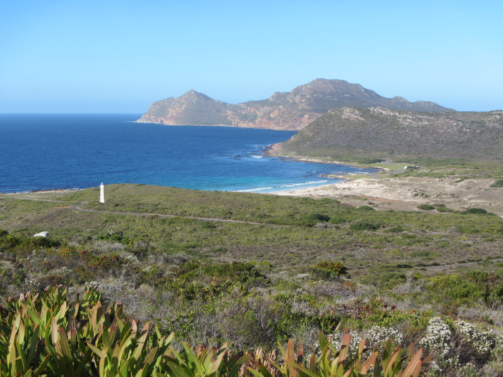
It was late afternoon when we arrived at the car park of Cape of Good Hope which is the most South-Western point of the African oontinent. We then walked up the koppie to the boardwalk towards Cape Point and had a refreshment at the Two Oceans restaurant before taking the hour long hike from there to Erica hut where we would stay overnight.
This appealing little cabin is perched quaintly on its own ridge with a panoramic view that stretches from False Bay on the one side to a distant Kommetjie on the other.
We got there as the sun was setting over the Atlantic Ocean. We had been on the go for 8,5 hrs and the thought of a hot shower and dinner with some red wine felt most appealing.


We left the following morning at 9am and headed back towards the main gate along the False Bay coast. The first 8kms were relatively easy going taking us past Matrooskop, disecting the Diaz and Da Gama Crosses en route to the Buffelsfontein Visitor Centre. The Centre, originally built in 1809 and restored in 2002, is a great place to stop and recharge the batteries, refill water bottles, etc before continuing up to Kanonkop.
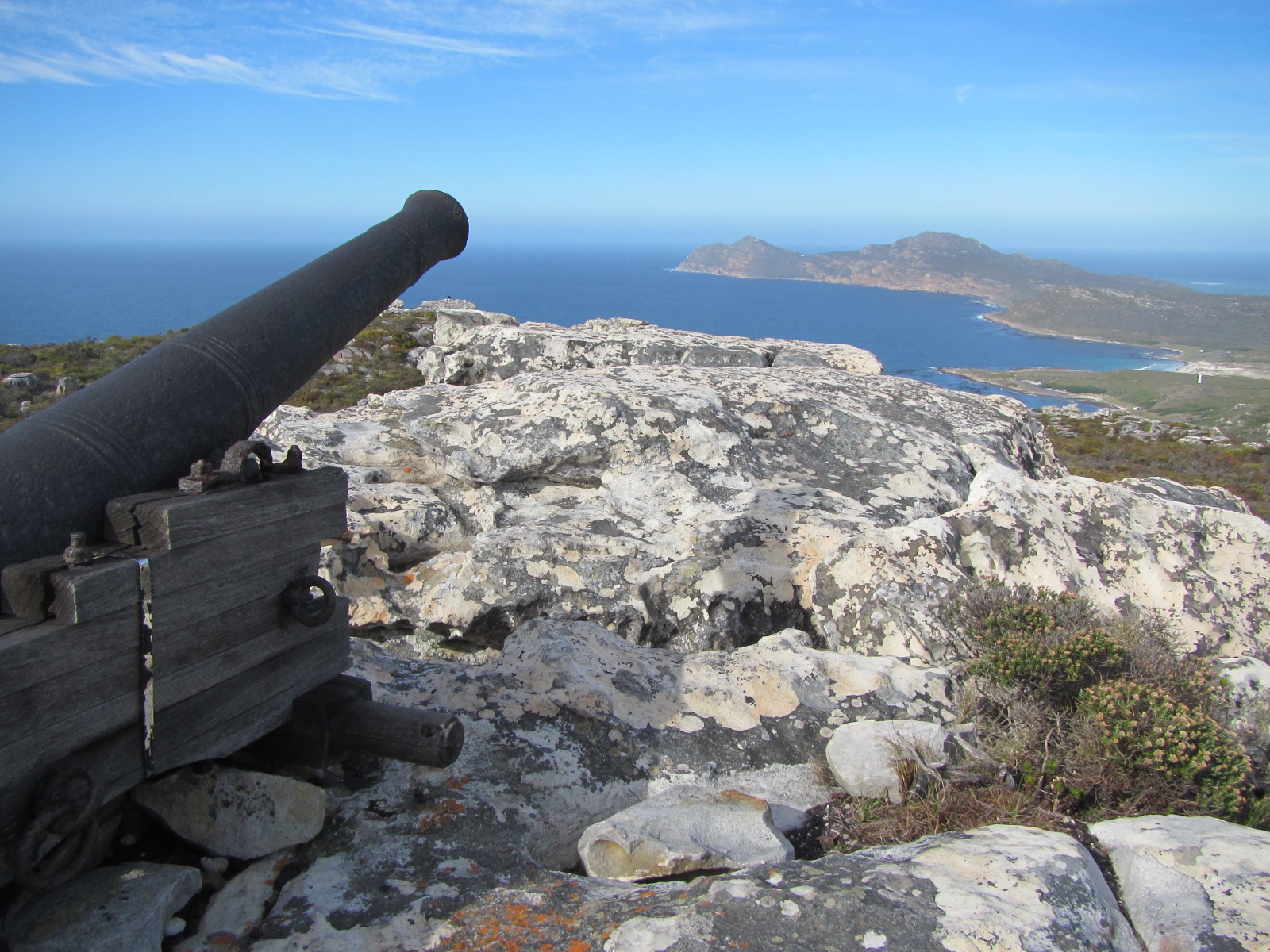
At the summit of Kanonkop perches its namesake, the signalling cannon that dates back to the early days of the Second British Occupation of the Cape and was used to signal Simon’s Town when ships arrived in False Bay. The old cannon on top of Kanonkop makes a good spot for a break.
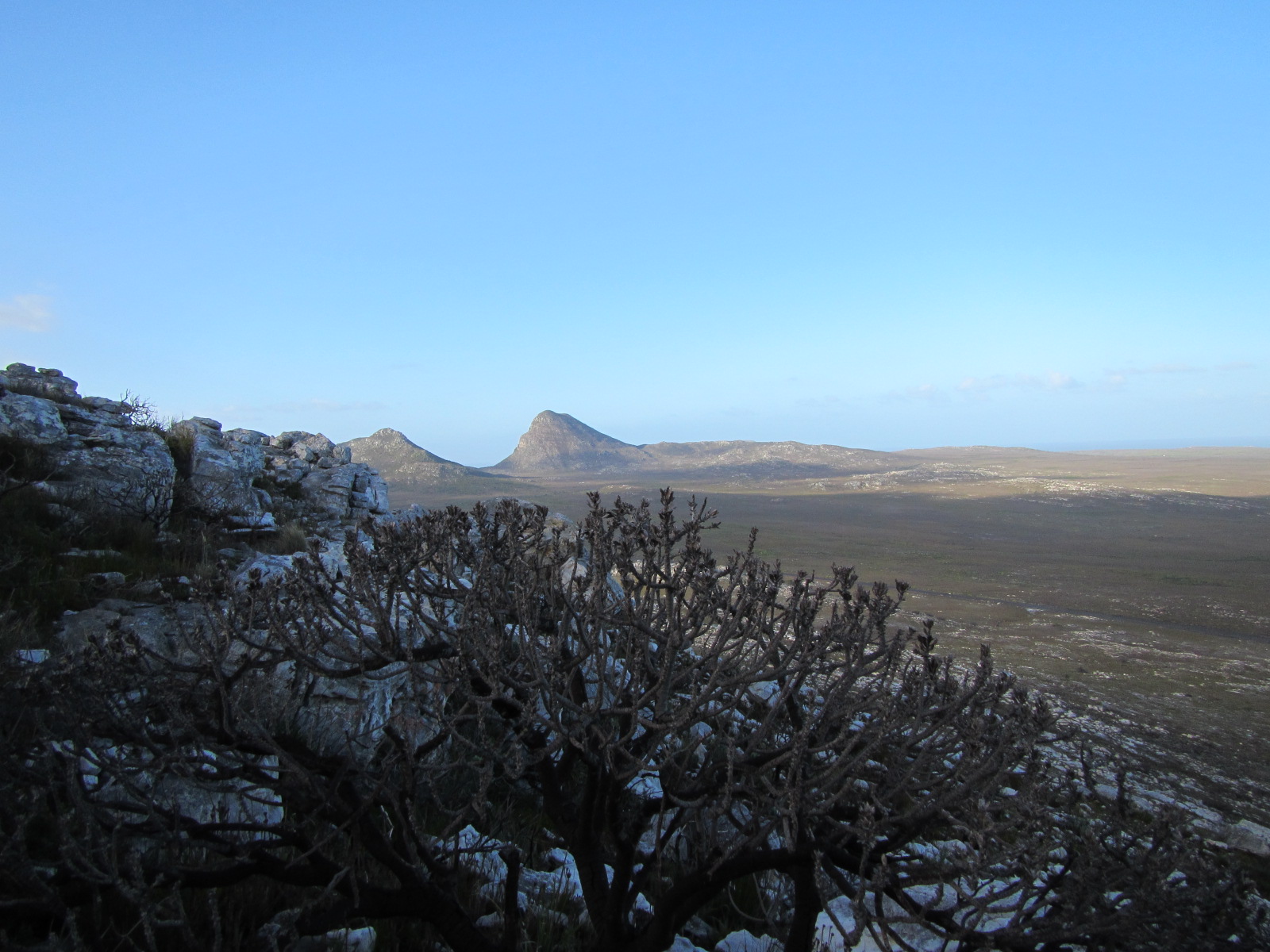
The last 5km of the trail becomes rugged as we wound our way around the three highest peaks in the area namely Paulsberg, Die Boer and Judas Peak.
Once at Judas Peak the trail starts to descend towards Smitswinkel Bay on the right towards the main gate which would mark the end of our hike.
This is a truely magnificent hike with views that will leave visitors in awe of the beauty of the Cape.
If you have the time then this is one trek that I highly recommend. One doesn’t have to be overly fit – the 15km day is a bit more hilly and strenuous but it can be done slowly with ample daylight time to spare. The 24km day is much flatter and easier walking (a bit of a meander) but is quite a distance so you need to keep moving.

